
1839
Maker: Mitchell/ Thomas, Cowperthwait & Co.
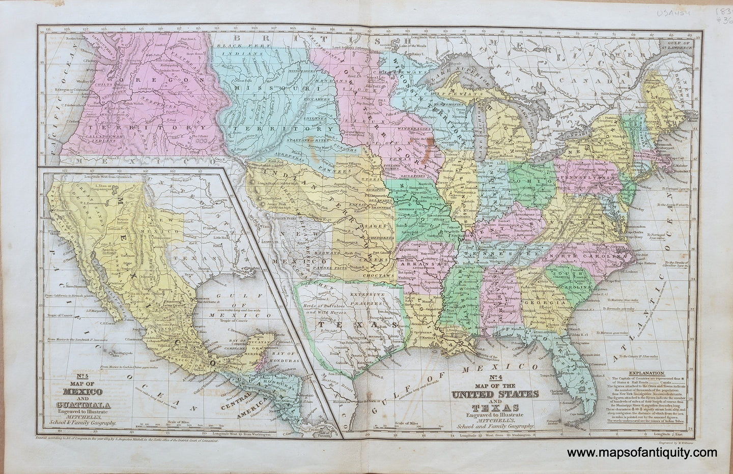
Antique map from Mitchell's Intermediate Geography, by Augustus Mitchell and published by Thomas, Cowperthwait & Co. in 1839. A fascinating glimpse into a moment of the development of the United States. This map shows the country before the Mexican-American War when Mexico had California, Arizona, and New Mexico. This map has Texas as a Republic in an unusual shape that is sometimes called the "strawberry shape" and the northern part of what is now Texas is labeled New Mexico. Includes a large Oregon Territory, Iowa Territory, Missouri Territory, huge Indian Territory, and large Wisconsin Territory. The northern boundary of Maine shows the US claim in the Aroostook War, which was happening at the time this map was published. Cities are noted, and includes some topography and identifies the Native Americans in some areas. Fold as issued. Good antique condition with some stains at center, and some minor image transfer that is most noticeable in the white parts of the image. Map measures approx. 10.25 x 16.5 inches to the neatline. Total page size is 12 x 18.25 inches.
Item Number: USA454