

Item number: CAR065
Genuine Antique Printed Color Folding Map
1955
Maker: Bank of Bermuda.
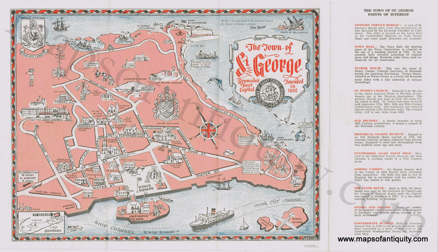
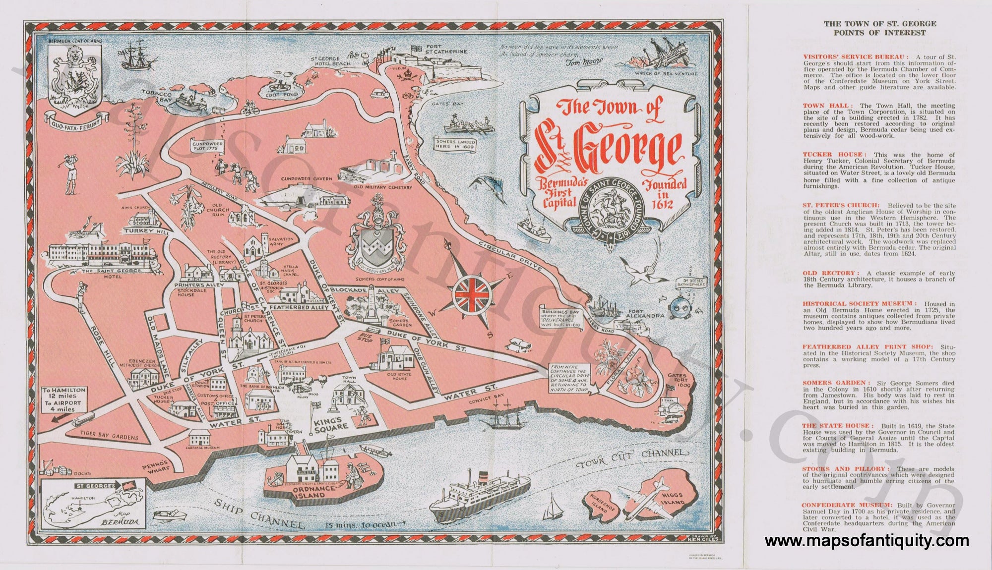
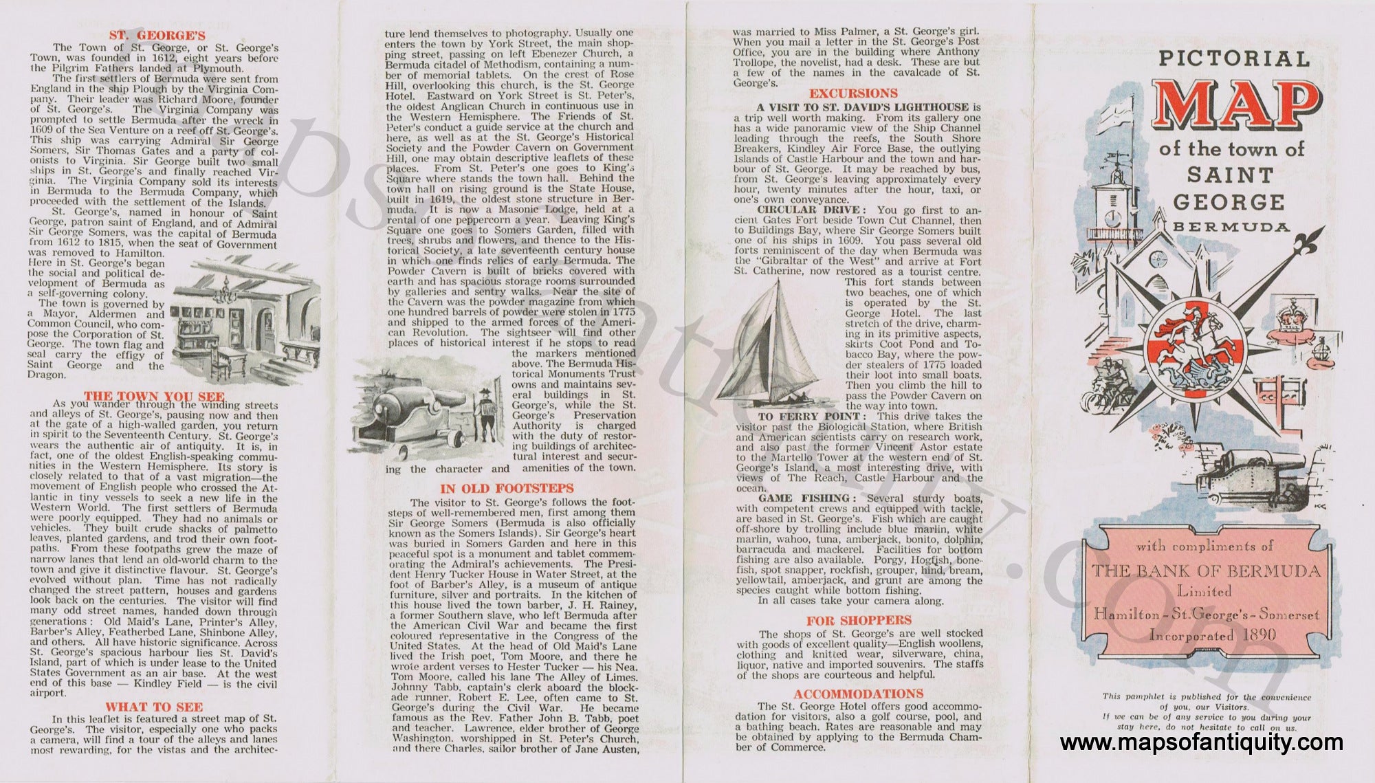
Antique printed color pictorial folding map of St. George's, Bermuda. Drawn by Ken Ciles, and published by the Bank of Bermuda in 1955. Map features a decorative border, cartouche, and compass rose, as well as a small inset map of the Bermuda Islands, the seal of the town of Saint George, the Somers Coat of Arms, and the Bermuda Coat of Arms. Includes names of major streets, historical facts, and points of interest (e.g. Gates Fort, Somers Garden, Town Hall, Fort St. Catherine, etc.) With folds, as issued. Very good overall antique condition with some mild toning of the paper. Map measures approximately 8.25" x 11" (H x W) to the neatline.
Item Number: CAR065