
1926
Maker: Melanie Elisabeth Leonard.
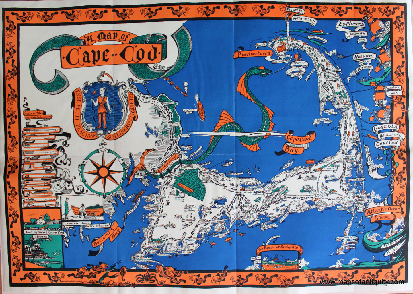
Antique printed color pictorial map of Cape Cod by Melanie Elisabeth Leonard, 1926. This fun and entertaining map shows cars streaming over the main roads of Cape Cod, bootleggers' boats in Cape Cod Bay, and a giant sea serpent with its tail as the canal. The map captures the whimsical character of the Cape in such vignettes as the fisherman saying to the tourist "Them ain't clams, them's cohags!" and the stack of books by Joseph C. Lincoln in Chatham. To the east side of the Cape are names and ships of the explorers who had stories about Cape Cod, including Hudson, who saw a mermaid. A decorative border of cod fish surrounds. Very good overall antique condition, with folds as issued. Approx. 23.75 x 34.25 inches to the border edge. **SOLD**
Item Number: MAS1759