
Item number: OTH001BW
Genuine Antique Map
1855
Maker: Colton.
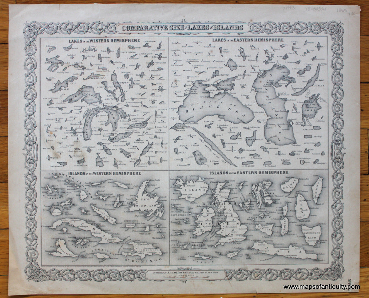
Fascinating black and white comparative map showing the sizes of Lakes of the Western Hemisphere, Lakes in the Eastern Hemisphere, Islands in the Western Hemisphere, and Islands in the Eastern Hemisphere. This chart was published two years before any European had seen Lake Victoria in Africa. By Colton, with Colton's recognizable ornate decorative border. Good condition with overall toning/ surface soiling, some minor stains and some edge tears including one at the top center that goes into the title, measures approx. 13 x 15.5 inches. Priced according to condition.
Item Number: OTH001BW