
Item number: NAM283
Genuine Antique Hand-Colored Map
1839
Maker: Mitchell.
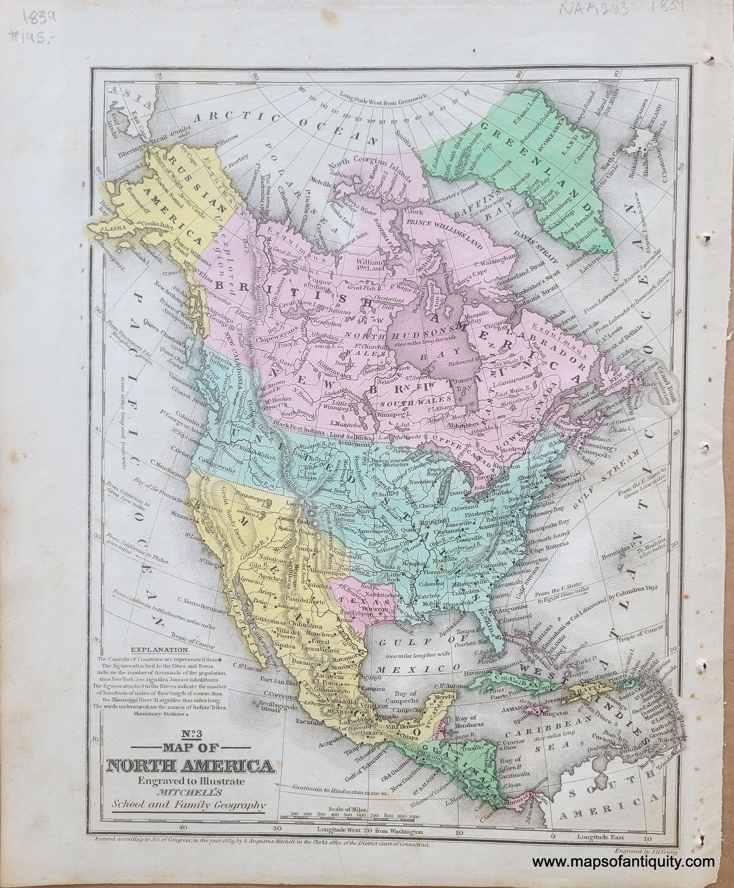
Antique hand-colored map of North America, by Mitchell, published in "Mitchell's School and Family Geography," 1839. This map captures a unique moment in the history of North America, when Texas was a republic, Russia owned Alaska, the United States had contested claims with Britain on the West Coast and in Maine, and Mexico still owned California and other south western states. Shows the republic of Texas in what some call it's "strawberry shape." Also shows topographical details and oceanic distances to other parts of the globe. Good to very good antique condition with overall toning, with some minor spots and stains mostly in the margins. Measures approximately 10.5" x 8" to the neatline.
Item Number: NAM283