
1821
Maker: Lavoisne.
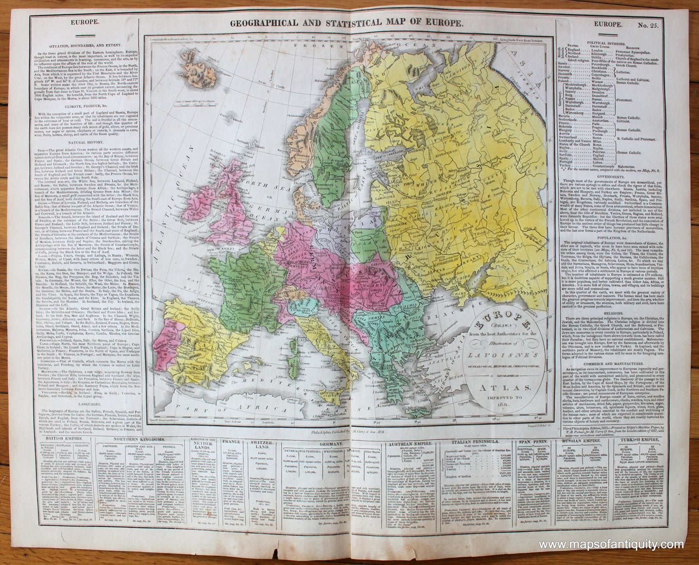
From A Complete Genealogical, Historical, Chronological, and Geographical Atlas; Being a General Guide to Ancient and Modern History: An Accurate Account of the Origin, Descent, and Marriages of the Principal Royal Families from the Earliest Authentic Records; Together with the Various Possessions, Wars, Celebrated Battles, and Remarkable Events, to the Year 1821" by Lavoisne, published by Carey & Sons, Antique hand colored map of Europe, surrounded by information on climate, languages, governments, religions, commerce, etc. Good overall antique condition with toning throughout, areas of mild foxing, some minor creasing/wrinkling, and a few mild tears at the outer edges. Total sheet dimensions are about 16 1/2"h x 20"w.
Item Number: EUR760