
c. 1541
Maker: Munster.
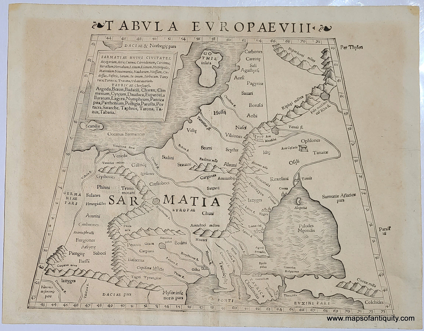
Antique black and white engraved Strabonis Ptolemeic map by Munster, circa 1541. This map shows an area of Eastern Europe from the Black Sea to the Baltic, including Crimea near the bottom center and Gotland at the top, with Ukraine and Poland in between. This map is very similar to MID058, but clearly a different edition due to the different titles. Essentially, Sarmatia was a collection of independent tribes, much like ancient Germania, that encompassed parts of modern Russia, Ukraine, the Baltic States, Central Asian nations and into central European countries such as Romania and Poland.
Sebastian Munster was a German geographer, cartographer, Hebraist, and theologian. In 1540 he published a Latin edition of Ptolemy's Geographia with illustrations. He produced new maps to supplement the Ptolemaic maps. The twenty-seven maps of the Ptolemaic canon are supplemented by twenty-one new maps. Further editions appeared in 1541 and 1542. In 1544 he published the Cosmographia one of the most successful works of the 16th century. It passed through 24 editions in 100 years, in different languages, including Latin, French, Italian, English, and even Czech. The last German edition was published in 1628. Munster died at Basel of the plague in 1552. Good to very good overall antique condition with uneven toning. Price has been adjusted for condition. Approximately 10.5 x 13.5 inches to the image edges.
Item Number: MID223