
Item number: USA286
Genuine Antique Hand Colored Map
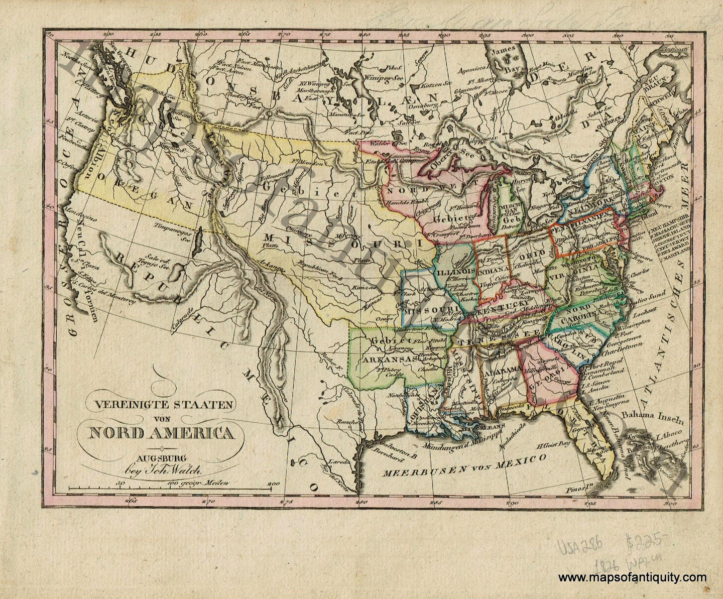
1826
Maker: Walch.
Antique hand colored map of the United States of America, Published in Walch's "Neuester Schul-Atlass," 1826. The only states west of the Mississippi River at this time were Missouri, Arkansas, and Louisiana (as well as the Oregon Territory and Missouri Territory.) Written in German. Very good overall antique condition with toning and mild foxing throughout, as well as some handwriting in pencil at the top of the map. Measures approximately 6.5" x 9" to the neatline.
Item Number: USA286