
Item number: MAS1803
Genuine Antique Printed Color Map
c. 1920s
Maker: Walker.
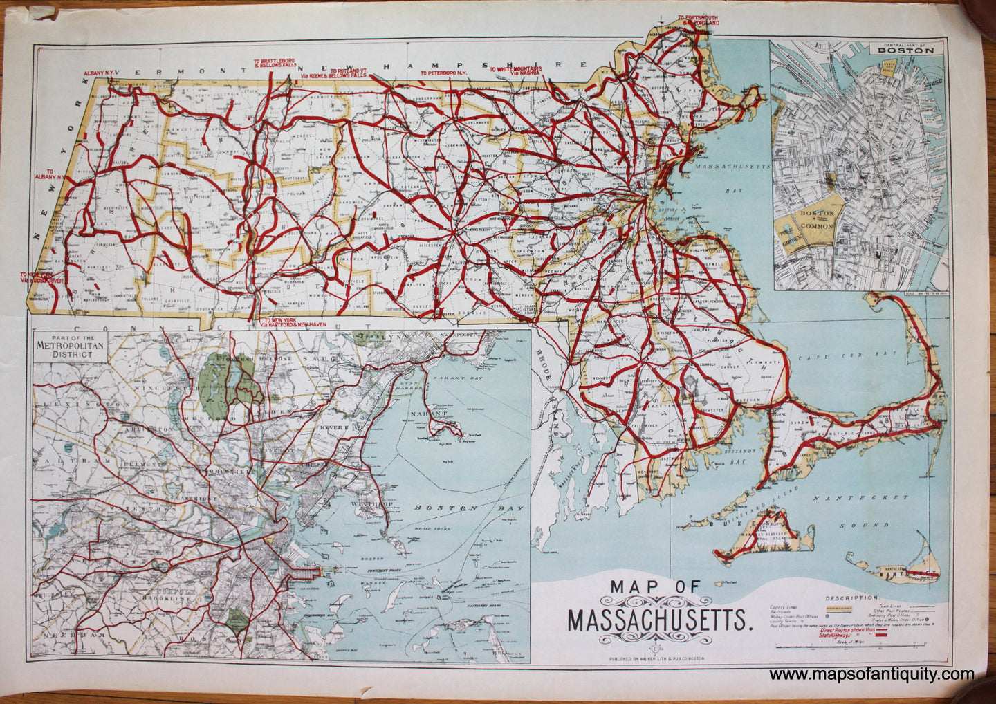
Antique printed color map of Massachusetts by George Walker, c. 1920s. This map features two inset maps, one showing a part of the Metropolitan District, and the other showing Boston proper. The bold red lines indicate direct routes (narrow lines) and State Highways (wide lines). These red lines are printed, despite appearing otherwise, and this is obvious because of the printed text in red. Exact date of publication is currently unknown to us. Very good condition with a few small edge tears, in margin only. Approx. 18 x 26.5 inches to the neatline.
Item Number: MAS1803