Winter hours: Tuesday - Saturday 10am to 5pm. Close Sundays and Mondays until May. We appreciate your business!

Antique-Printed-Color-Map-A-Map-of-CAPE-COD-and-the-Islands-Massachusetts-Cape-Cod-and-Islands-c.-1940-E.-D.-West-Co.-Maps-Of-Antiquity
1940 - A Map of CAPE COD and the Islands - Antique Map
  • Load image into Gallery viewer, Antique-Printed-Color-Map-A-Map-of-CAPE-COD-and-the-Islands-Massachusetts-Cape-Cod-and-Islands-c.-1940-E.-D.-West-Co.-Maps-Of-Antiquity
  • Load image into Gallery viewer, 1940 - A Map of CAPE COD and the Islands - Antique Map
  • Load image into Gallery viewer, 1940 - A Map of CAPE COD and the Islands - Antique Map

1940 - A Map of CAPE COD and the Islands - Antique Map

Regular price
$125.00
Sale price
$125.00
Regular price
Sold out
Unit price
per 
Shipping calculated at checkout.

Item number: MAS1819
Genuine Antique Printed Color Map

c. 1940

Maker: E. D. West Co..


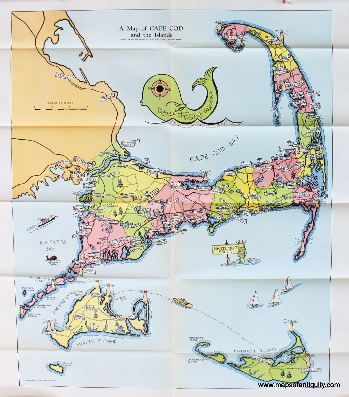
Brightly colored antique map of Cape Cod, Martha's Vineyard, and Nantucket created for and sold by the E. D. West Co., South Yarmouth, Mass. The map is not dated but was likely produced around the 1940s. Colored by town with labels for each town and village. The locations of lighthouses are represented, but not the specific lighthouses themselves. Both bridges are noted and the location of Camp Edwards is labeled, suggesting there may have been special interest in it due to the war. Most noticeably, the compass of the map is whimsically made by the eye of a large fish at the upper center. This map is available drymounted (for $150) or folded (for $125). Drymounted maps are not able to be shipped and must be picked-up in store. Very good condition with folds as issued. Approx. 21.75 x 18 inches to the neatline.


Item Number: MAS1819